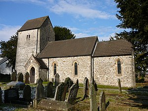
Church of St James, Rudry (Q117498): Difference between revisions
Jump to navigation
Jump to search
(Created claim: coordinate location (P26): 51°34'19.308"N, 3°9'56.660"W, #quickstatements; #temporary_batch_1709290426350) |
(Created claim: Wikimedia Commons media (P31): The church of St James, Rudry - geograph.org.uk - 1728709.jpg, #quickstatements; #temporary_batch_1725611532524) |
||
| (2 intermediate revisions by the same user not shown) | |||
| Property / CADW Building ID | |||
| Property / CADW Building ID: 13623 / rank | |||
Normal rank | |||
| Property / location | |||
| Property / location: Rudry / rank | |||
Normal rank | |||
| Property / Wikimedia Commons media | |||
| Property / Wikimedia Commons media: The church of St James, Rudry - geograph.org.uk - 1728709.jpg / rank | |||
Normal rank | |||
Latest revision as of 09:19, 6 September 2024
grade II listed building in Caerphilly County Borough. Above S side of a minor road between Caerphilly and Machen, in a large quadrangular churchyard
| Language | Label | Description | Also known as |
|---|---|---|---|
| English | Church of St James, Rudry |
grade II listed building in Caerphilly County Borough. Above S side of a minor road between Caerphilly and Machen, in a large quadrangular churchyard |
Statements
51°34'19.308"N, 3°9'56.660"W
0 references
